Project Adventrus: 10.10.2020

October 10, 2020
‘The woods are lovely, dark and deep, but I have promises to keep, and miles to go before I sleep, and miles to go before I sleep.’ BY ROBERT FROST

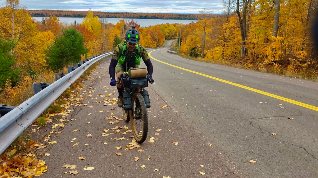
LEFT TO RIGHT: TODD POQUETTE, MARC SALM, CHUCK BOYER.
Saturday, October 10th, 2020: Round 1
- Stacie, Chuck, and I arrive at the Keweenaw Rocket Range later than planned. Planned to leave at 8:00am. Left about an hour late.
- Weather cold and overcast.
- Mike and Jenna Evans present - spectating and cheering.
- Justin Hoffmeyer, route collaborator through the Keweenaw, on-hand to guide us to Hancock.
- Took a picture of a ship for Mike Kessler, in remembrance of his father.
- The plan: ride 120-ish miles to Misery River.
- Left the Rocket Range via Mandan Road.
- Hoar Lake Road to Montreal Falls.

- Hike a bike.
- Hike a bike continues until we reach Smith Fisheries Road. A couple miles.
- Rode past Mt. Houghton
- Dropped into Lac Labelle and snagged a little pavement before returning to dirt headed toward Iron Gate.
- Conservancy Road (dirt) past Gratiot Lake.
- Big paved climb up to Phoenix - stopped at the market before heading over to Cliff Drive overlook.
- Stomach problems for me, bad cramps, moving into legs. Not a good sign on day one.
- Work through some chunky stuff going up and over Cliff Drive. Got a nice overlook, talked to a guy from Rock Solid.
- Reconnected to gravel on Five-Mile Road.
- Rock Pile Road brought us into Calumet, where we would get a surprise visit from Stacie and Cable. Billie was there for a planned stop.
- Worked out way down the peninsula via gravel and pavement sections, a solid pace.
- Stopped for a great view and pictures from atop Mt. Ripley, overlooking the canal and lift bridge. A highlight for sure.
- Justin left us in Hancock, and we dropped down to Houghton.
- Holiday Gas Station was serving dinner that night - roller grill stuff. Stomach was still an issue, cramping, but pushing through.
- Off we went, into the night toward Freda and searching for the Misery River.
- Coles Creek Road to Covered Road, couldn’t tell ya how it looked, pitch black.
- Got cold - very cold.
- Ripped through Freda.
- Disperse camped on Camp 16 Road, got off the main path by following an old two track into the woods.
- Marc fired up a fire to warm us.
- Setup camp for the night.
- Went to bed feeling shitty.
Sunday, October 11th, 2020: Round 2
- Alarm set for 5:30.
- Restless night, a 40 degree bag didn’t do the trick.
- Velodrome instant coffee for the win, and Marc tending a fire.
- Marc is drying out a pair of bibs when I notice they’re melting in his hand. He throws them in the fire.
- Break camp and peddle a few miles before having to cross the East Sleeping River.
- Filtered some water here.
- Following Snowmobile Logging Road. It’s pretty good.
- I recall a mix of gravel and pavement between Wilderness Drive and N. Firesteel Road. Pace was solid.
- Rolled into Greenland to find Billie waiting with McDonalds breakfast sandwiches. Best fucking sandwiches ever.
- Caledonia Road outta Greenland on our way to Rockland - enhanced! Chucky with big climbs. Gnarly.
- Lots of elevation change and up and down through this section, some great views of the fall colors.
- Kangas family stopped to say hi in the middle of nowhere - nice to see their smiling faces.

- Rolled into and through Rockland. No stop.
- Screaming descent outta town on Victoria Damn Road all the way to the Ontonagon River. Beautiful.
- Paid for the descent with an epic cimb outta there, at times close to 20% grade.
- Climbed up past Old Historic Victoria
- Victoria Road took us away from Rockland and the Ontonagon River Valley, greeting us with big ups and downs all the way to Norwich Road, which then transitioned to flat, fast gravel through the Ottawa.
- Eventually rolled off gravel and onto pavement for a fast section into Silver City at the foot of the Porcupine Mountains.
- Kangas Family was there, Stacie and Cable were there, and Billie. Hung out, did some gear swaps, ate, and got ready for the push into the park.
- Into the park and onto South Boundary Road we roll.
- Climb, climb, climb on a busy pavement road for miles.
- Pictures at the Presque Isle River.

- Onto Presque Isle Road for a bit, before turning into what would later be recalled as purgatory. Five-miles of hike-a-bike through barely maintained trails, traversing steep, washed out ravines every ¼ mile.
- Some nav issues in this area all the way to Black River as the trails on the map and our devices did not match.
- Spent three hours in there, in the dark, carrying 60-lb bikes up and down and over obstacles. Crazy fun stuff.
- Black River would have been magnificent, if we could see it, Rainbow Falls too.

- Crossed a suspension bridge in the middle of the night - 10pm?
- Into Jarvi Country. Man, another epic experience.
- Man Made ravines and obstacles for the express purpose of keeping people out. When you could ride your bike, the gravel was good, but when we traversed obstacles it was tough. Everyone was getting tired from hours of carrying bikes.
- Tom Bergman mapped this part of the route for us - and must have been at home having the sweetest of dreams thinking of our poor asses out there that night :-)
- Put Jarvi behind us (thank god) and headed out - but it was getting close to midnight and the prospect of making it all the way to the Montreal River Crossing appeared outta reach.
- Cue Vanea, out of nowhere, as we hit Lake Street. She pops out of her car with a pizza, which we all make quick work of.
- An audible is called and we determine a new camp location for the night. Vanea brings us there, then returns a bit later with water for us. A sweetheart for sure.
- We hunkered down and prepared for the incoming precipitation predicted to be significant.

Monday, October 12, 2020: Round 3
- Wind picked up overnight, it was so heavy I thought it was going to bring trees down on us.
- Later it calmed down a bit, and the rain came, and it rained.
- Around 10:00 I jumped under Marc’s tarp with him and we started talking about the game plan and other life things.
- Cooked up a little lunch.
- Tom Bergman stopped to say hi - and laughed at us.
- Christian Verardi shows up for support - we tell him the plan. Meet in Ironwood after 5:00pm.
- We plan to knock out the unfinished miles from our camp location, back into Ironwood.
- Once in Ironwood, Tom and Andrea offered their garage as a place to unpack and dry out before moving onto Iron River the next morning.
- We roll around noon - one o’clock.
- Wet, muddy, logging roads early.

- Make our way to Montreal Gorge - a highlight of the trip. Arrived there via an unnamed road.
- From the gorge we’re headed to cross the Montreal River.
- Struggled a bit at first figuring out where to cross the river (above or below the falls), eventually learned we had to go up river and cross above the falls.
- Easier said than done - it took us a while to figure out what we deemed the safest spot to cross.
- Got across the river (eventually) - and enjoyed a rather mildly enhanced ride into town.
- Saxon Falls Road to County Rd. B, Hendricksen Rd. etc. into town.
- Pizza and beer from Cold Iron Brewing, compliments of Tom and Andrea.
- Christian was there, hung out until we regrouped, and returned to Marquette with gear.
- The plan for tomorrow - get to Iron River (140 miles).
Tuesday, October 13: Round 4
- We can finish this thing! I knew it, by the end of the day, nothing was gonna stop us.
- Rolled outta town in the dark. Mosinee Grade wasn’t as bad as some thought it might be, a bit wet, but overall good.
- Crossed S County Rd. 519 and things got a little weird on Lakeshore Drive.
- It started to rain, so we busted out the rain gear.
- And Lakeshore Drive it would turn out - ends before connecting with the next road.
- Roamed around for an hour and a half in the hardwoods navigating our way outta there.
- Patience.
- On the other side, we find good gravel roads in the Ottawa.
- Vivid fall colors, lakes, and campsites fly by.
- We’re making good time, until we come to a bridge that is completely out (South Branch Presque Isle River).
- The construction crew helps us out and floats us and the bikes across on a make-shift raft. Win!

- Onto Job Corps Rd. and eventually past the old Marenisco State Prison.
- Past way too many awesome lakes to name on our way into Land O Lakes. Stopped briefly at Charlie’s Market for lunch.
- Rolled on, into, and through Watersmeet.
- Stopped for a quick picture and kept going.
- Took old US2 East - good road, connecting to the Iron River-Marinsco Trail - also good.
- Tamaracks were amazing.
- Winfield meets us somewhere in the dark on FF-16 and delivers waterproof gloves. What a guy!
- Benjamin meets us five miles from town and rides in with us - he has arranged a warm place to sleep and ordered pizza. Unbelievable how giving everyone has been.
- Hig three daughters and father are waiting for us when we hit the outskirts of town, they ride in with us.
- Cow bells!
- Pizza from outer limits.
- Craig Bengry stops by to say hi!
- Highly suggest this segment as a bikepack route.
- Chuck tells us he’s done when we get to Gwinn the next day.

Wednesday, October 14, 2020: Round 5
- Goal - make it to Gwinn
- Got out early, around 7:00am
- Some gravel, some pavement, some rail trail.
- Decent ride to Crystal. Avoided rain.
- Reached Crystal Falls, James Morrow met us and decided to ride with us until Two-Mile Road.
- Pavement outta Crystal for a ways, rain starts to fall.
- Rolling steady toward Sawyer Lake via Big Wheel Road, Lake Oneil Road, etc.
- Past Silver Lake Resort we turn onto Two-mile Road. Rough road. James eventually drops off and wishes us well, he’s on his way to spend the balance of the day with family.
- Chuck is gone - pushed ahead of Marc and I, leaving the two of us together the rest of the day.

- I recall a wide variety of remote roads that ranged from rough and bumpy, to wet and muddy, to downright nasty in logging areas.
- Marc nearly got hit by a pickup truck who clearly wasn’t expecting to see anyone where he found us.
- First sign of drivetrain wear pops up, grinding, grinding. Trying to keep it clean to no avail.
- Pretty damn desolate area
- Ran into a sort of shrine in the middle of nowhere - Hans Fazer Memorial Highway.

- West Branch State Forest Campground
- West Branch Escanaba River
- Rain.
- Wind.
- Nav issues around Kate’s Grade with a road that did not match up to our file.
- Figured it out and got onto Camp 10 Road
- Rolled through Bass Lake, Crooked Lake, Shag Lake and more; mix of gravel and pavement.
- Arrived at Old Towne Inn to find Stacie, Jon, and Tony waiting for us
- Chuck had pushed on to our house and was gone.
- Jon and Tony took our bikes to the car wash to clean them up.
- Stacie brought dinner from Casa Calabria, and a bunch of other misc stuff.
- Marc and I focused on cleaning up packs and gear in the tub - mud everywhere.
- Lots going on in a small space.
- We were up late sorting our gear, making a plan for tomorrow, and getting Stacie on her way.
- Around midnight I checked my brakes only to learn they were shot, and the brake pads I had with me lacked the necessary spacer.
- Looked like we were screwed.
- Connected with Spencer from West End Ski and Trail, who showed up at the hotel in the morning (6:30) with brake pads for me. SAVED THE DAY!
Thursday, October 15, 2020: Round 6
- Experienced some garmin issues leaving town - think it was water in the connection between the 1030 and external battery pack.
- Eventually sorted it out by disconnecting the external pack and running the unit alone.
- Left town via Muehrcke Road.
- The first twenty miles or so outta Gwinn were rough, wet, and slow.
- My drivetrain continued to take a beating.
- I recall Perrin Brothers Road - also slow.
- We hit Cty Rd 557 and pavement - speed!
- Game farm.
- Major opportunity to pick up time, passed by Escanaba River.
- Cruised through Cornell, started to rain at some point too.
- Busted outta Brampton and rolled into Rapid River where Billie and Craig were waiting for us.
- Quick lunch in the backseat, Culvers burgers and cheese curds.
- Get reloaded with water and nutrition - rolled out.
- Outta Rapid, two tracks and gravel roads. A blend of fast and not quite slow stuff.
- Hiawatha National Forest
- Amazing fall colors - bright vibrant yellows

- Tara met us at FF HWY 13 - shared some of the most amazing choc chip cookies ever made.
- Left her and made good time across KK Road, Bass Lake Road, 437, and more.
- Blasted through Stueben
- As it was turning dark we met Tara and Billie at Hwy 94. Opted to push another twenty miles to West Branch Campground.
- We didn’t get a few miles down the road and we ran into what might have been the most difficult mile of the trip.
- In the dark, had to push through a road that has been decommissioned long ago. Huge trees down, water hazards, deep water! Took a couple hours or more to go one damn mile.
- Eventually hit Stutts Truck Trail.
- It got late, cold.
- Another 14-hour day.
- Rolled into camp, greeted by Billie, Tara, and Amy with a fire!
- Late night, turned in after midnight. Planned to get up around 6:00 and roll.
- I had a PBR, was reminded why I don’t drink PBR

Friday, October 17: Round 7
- Our first 100-mile sand century, the first of several.
- Took Highwater Truck Trail outta camp.
- It was a nice morning.
- Cold.
- Crossed the Manistique River.
- Onto Floodwoods Road.
- Lake Superior State Forest
- Seney Wildlife Preserve
- SAND
- Bear Creek Swamp
- Ice on the bridges that morning
- Met Billie at 77.
- Down H42 for a bit before turning off on a dirt road that turned into a snowmo trail.
- S Curtis Road would take us into and through Curtis, had a good run up to Curtis and out on pavement.
- Then we hit Forest Trail, and you worked for literally every inch in the sand
- 300w at about 5mph.
- No hills, flat sand.
- Hayes Road and Cty Rd 468 - screw you!
- Many, many motorcycle trails, roads torn up by em
- Pullup Road - surprise - sand!
- Drivetrain was reaching epic bad
- Slowly grinding past Pullup Lake
- Took Dollar Lake Road past… Dollar Lake
- Bumpy, wet, slow
- Hog Island Road, Strouble Lake Road - why do you hate us?

- Caffey Trail - rain and snow
- Conditions get bad - we waited to put on rain gear to long
- Eventually, I could not shift the bike, and my hands were so numb I couldn’t use em.
- Stopped at the pipeline - had to regroup.
- Amy and Dan brought us into St Ignace.
- Good learning experience
- Had to tear down all gear and packs again to dry out.
- Whaley arranged for pulley wheels to come to town the next morning, and Marc had a chain for me to use.
- Would work on fixing everything in the morning.
- Billie had a great pasta dinner waiting for us
- Reminded again - we’re lucky

Saturday, October 18: Round 8
- Derailleur pulleys shot, chain shot, bakes shot
- We aren’t moving till the bike is fixed.
- Late start, rain and snow forecasted.
- Got out by around 11, back to the pipeline to pick up where we left off
- Get as many miles knocked down before weather gets too bad
- Off the gas line to Dam Road.
- Across the Brevort River
- Snow on the ground on Brevort Lake Road, Round Lake Road - roads fairly fast.
- Met Kit Husky who was going the other way on a MTB
- Got into St Ignace pretty quickly, saw Billie, Stacie, and Gavin.
- Ate some pizza, chips, and pulled out the rain gear.
- Weather moving in.
- Grabbed a photo of the bridge from Straits State Park

- Wind was strong, but also at our back as we left St Ignace. A win!
- Guess what - no real sand today :-)
- Kelsy Kellerman checked on us while we're riding north on H-53.
- Back into Hiawatha National Forest via Red Creek Road.
- Forest Service road.
- Weaving back and forth across East Lake Road, in and out of forgotten forest trails.
- Raining.
- After about 50-miles, we jumped off course at HWY-40, and headed into Trout Creek.
- Tore down packs and gear to dry out again.
- Had a chance to have dinner with Marc and Billie - that was nice.
- Pasties.
- Nice to have a night with Stacie and Gavin.
- Got a good night's rest.
Sunday, October 19: Round 9
- The goal: Push to Grand Marais
- Big day, 140 miles
- Started in the dark, back to Highway 40
- Morning rain
- Cruising South Hayward School Road to South Dick Road.
- Onto Sweiger Truck Trail
- Early morning trails consisted of gravel and old grown in forest roads
- Then sand, and lots of it, all the way to HWY 28 where we met Billie
- Onward to East/West Road - I think it was ok, probably more sand
- Connecting to Lake Superior Shoreline Road, Stacie waiting for us at the corner with McDonalds sandwiches - a wonderful surprise
- Gavin wanted to get home to watch the lions
- Strong push on pavement via M-123 past Tahquamenon River, into Paradise, and onto Whitefish Point.

- Billie was waiting for us there
- Grabbed a couple quick pics, ate, and headed back to Doe Lake Road - it was everything we hoped it wouldn't be :-)
- SAND
- Water holes, mud holes - met a group of UTVs, one of them stuck in a mud hole.
- W Dam Rd, Andrus Rd, Sheldrake River Rd, W Betsy River Road, Wide Water Road, all I remember is sad. So deep, all ya could do was push.
- Eventually made our way back out to M-123, not before getting passed by a couple of trucks full of hounds looking for bears.
- Met Billie, refueled, rolled
- Turn onto Northwestern Road, Billie one last time, a couple miles down the road, snow
- Washboard/rough road decent amount of traffic, onto HWY 414
- Onto Little Two Hearted Road, more sand, views that reminded us of the Mulligan Plains. Sunshine.

- Hit Deer Park Rd and cruise past Muskallonge State Park - it’s dark now
- Pine Ridge ORV trail, a fun little trail in the dark that reminded us of singletrack
- Wheeler Lake Road and Sucker River Road weren’t the best, but also not the worst
- It was getting late, I took a bad line and went down in one of the puddles, didn’t matter though cause I was already soaked
- Hit H58 and cruised five-miles into town
- Nearly a 16-hour day
- On the ride to Grand Marais I made the decision to end my ride when Marc was down Monday. This mission had always been a group mission, and we had spent every damn minute of it together in the trenches. The thought of continuing on, to “finish” alone without Marc who had to go to work, didn’t sit well with me. Even sitting here today, I have no regrets. It was the right thing to do.

Monday, October 20: Day 10
- Late start - around 8:30
- Enjoyed homemade burritos compliments of Amy - so good
- H58 to Munising - see Billie
- More Burritos
- Could tell we were getting back toward Marquette and Munising - more hills. Hadn’t seen a hill in days.
- I exercised creative freedom and modified the route out of Munising - wanted to route around some water BS and set us up to get done by 6:00, giving Marc and Billie a decent departure time.
- Stopped at Deer Lake for a photo
- Today was the first day our conversations did not focus on the mission, and we could actually small talk, share.
- One of my favorite points in the trip, no more pressure, just ride.
- Took us into gravel in Deerton, followed a classic route I used to train all year long.
- Eventually connected via Magnum and Green Garden to the route up by Heitman, and followed the route into town.
- Whaley caught us down on Magnum and welcomed us home - he did it because he couldn't be at the school where everyone else planned to catch us as we rolled in
- Good Dude
- Group of cheering people at the school waiting.
- Cow bell.
- $1.00 BILL split in half with Mark


